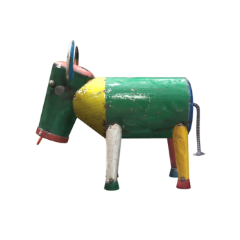
Sculpture/Artifacts
ornaments
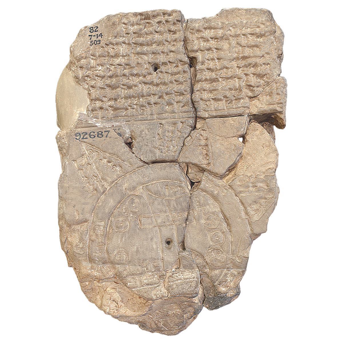
Clay slabs from the Assyrian period in Babylon, titled 'Intentions of the Babylonian World'
Clay slabs from the Assyrian period in Babylon, titled 'Intentions of the Babylonian World'
423 View
This is a Babylonian clay tablet written in Akkadian. It was created no earlier than the 9th century BC (more likely in the 8th or late 7th century BC). This map is centered around the Euphrates River, flowing from the north to the south. The map is marked with "Babylon" and is located in the northern half of the map. The outlet of the Euphrates River is marked with "swamp" and "outflow outlet". Susa, the capital of Elam, is located in the south, with Urartu in the northeast,. Mesopotamia is surrounded by a circular "river" called the "Bitter River" or the ocean, with seven or eight "regions" depicted as triangular areas outside the ocean.
The copyright of the 3D model belongs to the original author and the material may not be distributed, published, transmitted, copied, rented, resold or compiled in any form.
Related Models


We're here to help
Frequently asked questions about this 3D model
Q1: What file formats are available for downloading this Clay slabs from the Assyrian period in Babylon, titled 'Intentions of the Babylonian World' 3D model?
We offer a variety of popular 3D file formats for download, including but not limited to OBJ, FBX, GLTF, STL, USDZ, GLB, 3DMAX, 3DS, MAX, C4D, and
Blender, ensuring compatibility across different software and platforms.
We offer a variety of popular 3D file formats for download, including but not limited to OBJ, FBX, GLTF, STL, USDZ, GLB, 3DMAX, 3DS, MAX, C4D, and Blender, ensuring compatibility across different software and platforms.
Q2: How do I open the downloaded Clay slabs from the Assyrian period in Babylon, titled 'Intentions of the Babylonian World' 3D model files with software?
Your downloaded Clay slabs from the Assyrian period in Babylon, titled 'Intentions of the Babylonian World' 3D model files (such as OBJ, FBX, GLTF, etc.) can be opened and edited using various professional 3D software. Commonly
used software includes:
Professional 3D Modeling Software: Blender (free and open-source), Autodesk Maya, 3ds Max, Cinema 4D (C4D), ZBrush, SketchUp, etc.
CAD/Engineering Software: For formats like STL, you can also import them into software such as AutoCAD or SolidWorks for viewing or
modification.
3D Printing Slicing Software: If you plan to 3D print, STL files can be directly imported into slicing software like Cura, Simplify3D, or
PrusaSlicer for processing.
Viewers/Lightweight Software: Some formats (like GLB, USDZ) can even be opened directly in Windows' built-in 3D Viewer, Apple's "Preview"
app,
or various online 3D viewers.
Typically, you just need to use the "File" menu's "Import" or "Open" function in your chosen 3D software
and
select your downloaded model file. If you encounter compatibility issues with a specific format, you can try converting it to another common format or
consult
the software's official documentation.
Your downloaded Clay slabs from the Assyrian period in Babylon, titled 'Intentions of the Babylonian World' 3D model files (such as OBJ, FBX, GLTF, etc.) can be opened and edited using various professional 3D software. Commonly used software includes:
Professional 3D Modeling Software: Blender (free and open-source), Autodesk Maya, 3ds Max, Cinema 4D (C4D), ZBrush, SketchUp, etc.
CAD/Engineering Software: For formats like STL, you can also import them into software such as AutoCAD or SolidWorks for viewing or modification.
3D Printing Slicing Software: If you plan to 3D print, STL files can be directly imported into slicing software like Cura, Simplify3D, or PrusaSlicer for processing.
Viewers/Lightweight Software: Some formats (like GLB, USDZ) can even be opened directly in Windows' built-in 3D Viewer, Apple's "Preview" app, or various online 3D viewers.
Typically, you just need to use the "File" menu's "Import" or "Open" function in your chosen 3D software and select your downloaded model file. If you encounter compatibility issues with a specific format, you can try converting it to another common format or consult the software's official documentation.
Q3: Can this Clay slabs from the Assyrian period in Babylon, titled 'Intentions of the Babylonian World' 3D model be used for 3D printing?
Yes, this Clay slabs from the Assyrian period in Babylon, titled 'Intentions of the Babylonian World' 3D model fully supports 3D printing. You can download formats suitable for 3D printing, such as STL, to create exquisite
physical
models for collection, display, or educational purposes.
Yes, this Clay slabs from the Assyrian period in Babylon, titled 'Intentions of the Babylonian World' 3D model fully supports 3D printing. You can download formats suitable for 3D printing, such as STL, to create exquisite physical models for collection, display, or educational purposes.
Q4: Can I experience this 3D model on spatial computing devices like Apple Vision Pro or Meta Quest?
Absolutely! We've optimized this Clay slabs from the Assyrian period in Babylon, titled 'Intentions of the Babylonian World' 3D model to provide an excellent immersive 3D visual experience on spatial computing devices like
Apple
Vision Pro and Meta Quest, allowing you to appreciate its details up close in a virtual environment.
Absolutely! We've optimized this Clay slabs from the Assyrian period in Babylon, titled 'Intentions of the Babylonian World' 3D model to provide an excellent immersive 3D visual experience on spatial computing devices like Apple Vision Pro and Meta Quest, allowing you to appreciate its details up close in a virtual environment.
Q5: Does this Clay slabs from the Assyrian period in Babylon, titled 'Intentions of the Babylonian World' 3D model set include texture or material information?
Our Clay slabs from the Assyrian period in Babylon, titled 'Intentions of the Babylonian World' 3D models typically include basic texture or material information, allowing you to render them directly or apply them in your
projects.
You can customize them as needed to achieve the best visual results.
Our Clay slabs from the Assyrian period in Babylon, titled 'Intentions of the Babylonian World' 3D models typically include basic texture or material information, allowing you to render them directly or apply them in your projects. You can customize them as needed to achieve the best visual results.
Q6: Can this Clay slabs from the Assyrian period in Babylon, titled 'Intentions of the Babylonian World' 3D model set be used for game development or educational purposes?
This Clay slabs from the Assyrian period in Babylon, titled 'Intentions of the Babylonian World' 3D model set is highly suitable for game development, educational demonstrations, cultural exchange projects, and personal
non-commercial use. Please refer to our usage agreement for specific licensing details.
This Clay slabs from the Assyrian period in Babylon, titled 'Intentions of the Babylonian World' 3D model set is highly suitable for game development, educational demonstrations, cultural exchange projects, and personal non-commercial use. Please refer to our usage agreement for specific licensing details.
Q7: Can the downloaded 3D model be used for commercial projects or game development?
Before using this Clay slabs from the Assyrian period in Babylon, titled 'Intentions of the Babylonian World' 3D model, please carefully read our licensing agreement. Typically, downloaded content is restricted to personal
learning
and internal use.
Before using this Clay slabs from the Assyrian period in Babylon, titled 'Intentions of the Babylonian World' 3D model, please carefully read our licensing agreement. Typically, downloaded content is restricted to personal learning and internal use.
Q8: Can I browse or view this 3D model on my phone?
Yes, you can view and preview this 3D model on your phone conveniently. You can view the model on your phone by the following ways:
iOS/Android devices: Download the freecreat app from the Apple Appstore, register and login to your freecreat account on the app, you can view the 3D model
on
your phone and support to view the model in Augmented Reality (AR) mode and even " place" it in the real environment.
Swipe: Using the freecreat app, open the swipe function and swipe the code on the freecreat page to view the 3D model on your phone.
Online Preview: Our page offers an online 3D preview feature that allows you to visit the page directly in your mobile browser and view the model without
downloading.
Yes, you can view and preview this 3D model on your phone conveniently. You can view the model on your phone by the following ways:
iOS/Android devices: Download the freecreat app from the Apple Appstore, register and login to your freecreat account on the app, you can view the 3D model on your phone and support to view the model in Augmented Reality (AR) mode and even " place" it in the real environment.
Swipe: Using the freecreat app, open the swipe function and swipe the code on the freecreat page to view the 3D model on your phone.
Online Preview: Our page offers an online 3D preview feature that allows you to visit the page directly in your mobile browser and view the model without downloading.
Q9: If I have further questions about this Clay slabs from the Assyrian period in Babylon, titled 'Intentions of the Babylonian World' 3D model, how can I contact you?
If you have any questions about the Clay slabs from the Assyrian period in Babylon, titled 'Intentions of the Babylonian World' 3D model, require technical support, or have other collaboration inquiries, you can contact us
using
the contact information provided at the bottom of the page or by sending an internal message after logging in.
If you have any questions about the Clay slabs from the Assyrian period in Babylon, titled 'Intentions of the Babylonian World' 3D model, require technical support, or have other collaboration inquiries, you can contact us using the contact information provided at the bottom of the page or by sending an internal message after logging in.
Popular Models

Tanks

1914 Rolls-Royce armored car
large truck

1967 Ford Mustang Fast Back Edition

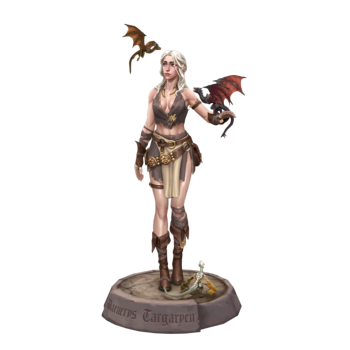
Daenerys Targaryen
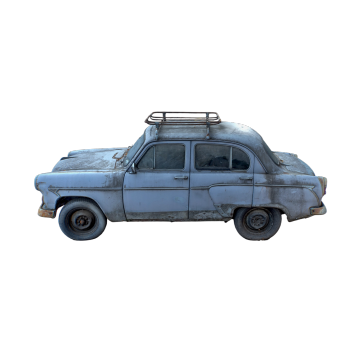
Muscovites 407
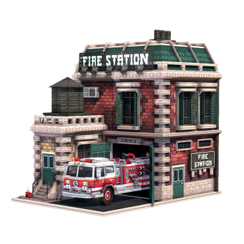
Fire station